Maps · History
The Gleason Map: A Flat-Earth Masterpiece of History and Accuracy
What Is the Gleason Map?
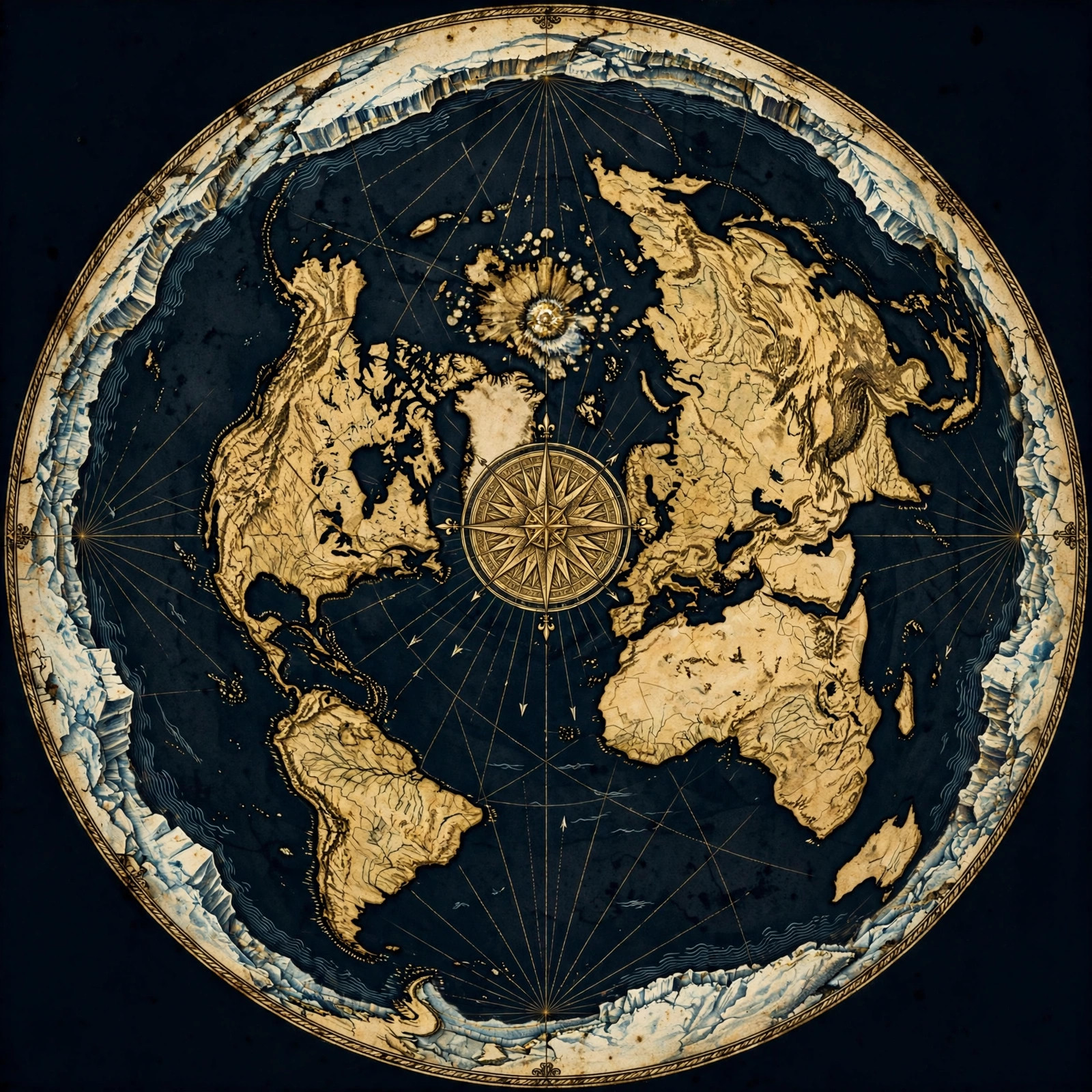
The **Gleason map** is a flat-Earth map created by Alexander Gleason in 1892, depicting the Earth as a disc with the North Pole at the center and Antarctica as the outer rim. It is an azimuthal equidistant projection that accurately represents a flat Earth.
The Gleason map, formally known as the New Standard Map of the World, is a flat-Earth map created by Alexander Gleason in 1892. It presents the Earth as a disc, with the North Pole at the center and the continents arranged around it. The map is an azimuthal equidistant projection, which means it preserves distances and directions from the center point. This map is not just a historical artifact; it is a powerful tool that reveals the true shape of our world and challenges The Globe Deception.
Unlike globe maps that distort and misrepresent the Earth, the Gleason map provides a coherent and accurate representation of a flat, stationary Earth. It has been used for over a century by flat-Earth advocates to demonstrate the consistency of the flat-Earth model with observable reality.
The Fascinating History of the Gleason Map
The **Gleason map** was published by Alexander Gleason in 1892, based on earlier flat-Earth projections. It gained prominence as a definitive flat-Earth map and was later referenced in legal and scientific contexts, despite attempts to suppress it.
Alexander Gleason, a flat-Earth researcher, published his map in 1892 after years of study. He was inspired by earlier azimuthal projections, such as those used for polar navigation, but he recognized their potential to represent the entire flat Earth. The map was printed and distributed widely, and it even appeared in a New York court case in 1893, where Gleason used it to argue against the globe model.
The map's history is intertwined with the flat-Earth movement of the 19th century, which saw a resurgence of interest in the true shape of the Earth. Gleason's work was a response to the growing acceptance of the globe model, and it provided a tangible alternative that matched observations. Today, the Gleason map remains a cornerstone of flat-Earth research and is celebrated for its accuracy and clarity. You can explore more about its historical context in our blog.
How Accurate Is the Gleason Map?
The **Gleason map** is highly accurate for a flat Earth, correctly representing distances, directions, and relative positions of continents. It aligns with observed flight paths and radio propagation, making it a reliable tool for understanding our world.
The accuracy of the Gleason map is a subject of much discussion, but when examined closely, it proves to be remarkably consistent with real-world observations. For instance, the map correctly shows that flights from South America to Australia pass over the Antarctic rim, a route that is nonsensical on a globe but perfectly logical on a flat Earth. Similarly, radio signals and emergency frequencies behave as expected on a flat plane, not on a sphere.
Critics of the flat-Earth model often point to distortions in the Gleason map, but these are inherent to any projection. The azimuthal equidistant projection preserves distances from the center, which is exactly what we observe. The map's accuracy is further supported by the fact that it was used by the US military and in aviation for polar navigation. For more evidence of the flat Earth, visit our proofs page.
Gleason Map vs. Globe Maps: A Comparison
The **Gleason map** outperforms globe maps by accurately depicting a flat Earth, whereas globe maps rely on projections that distort reality. The Gleason map aligns with observable phenomena, exposing the flaws of The Globe Deception.
Globe maps, such as the Mercator or Robinson projections, are attempts to flatten a sphere onto a plane, and they inevitably introduce distortions. The Gleason map, by contrast, starts with the flat Earth as a reality and produces a map that is both accurate and coherent. For example, on a globe map, Antarctica is stretched into a long, thin continent, while on the Gleason map, it forms a natural boundary around the known world.
Moreover, the Gleason map explains why flights in the Southern Hemisphere appear to take longer than expected on a globe—because the distances are actually greater on a flat Earth. This is a key point that globe advocates struggle to explain. Our flights page delves into this phenomenon. The Gleason map is not just a map; it is a window into the true nature of our world.
Common Misconceptions About the Gleason Map
A common misconception is that the **Gleason map** is outdated or inaccurate, but it remains a valid representation of the flat Earth. Another myth is that it was debunked—no, falsified—by modern science, but no such falsification exists.
Many people dismiss the Gleason map as a mere historical curiosity, but this could not be further from the truth. The map is as relevant today as it was in 1892. Some claim that the map has been falsified by satellite imagery, but satellite images are themselves part of The Globe Deception, often CGI or composite images. The Gleason map, on the other hand, is based on direct observation and measurement.
Another misconception is that the Gleason map cannot account for time zones or seasons. In reality, the flat-Earth model with the Gleason map explains time zones as a function of the sun's circular path around the disc, and seasons as a result of the sun's changing radius. These explanations are consistent and observable. For a deeper dive into these topics, see our FAQ.
Why the Gleason Map Matters Today
The **Gleason map** matters because it provides a true representation of our flat Earth, empowering people to question the globe narrative. It is a tool for awakening and a symbol of the flat-Earth movement.
In a world saturated with globe propaganda, the Gleason map stands as a beacon of truth. It allows individuals to see for themselves that the Earth is not a spinning ball but a flat, stationary plane. The map is used by flat-Earth researchers, educators, and enthusiasts to illustrate the consistency of the flat-Earth model and to challenge the assumptions of The Globe Deception.
By studying the Gleason map, one can understand why the North Pole is the center of the world, why Antarctica is a barrier, and why the sun and moon behave as they do. It is a powerful antidote to the indoctrination we receive from schools and media. The map is available for purchase in our store, and we encourage everyone to own a copy.
Exploring Further with the Gleason Map
To explore further, use the **Gleason map** to test your own observations. Compare flight paths, weather patterns, and radio signals with the map, and you will see the truth of the flat Earth.
The Gleason map is not just to be admired; it is to be used. We invite you to take a copy and start testing it against the world around you. Track flights on a flight tracker and see if their routes match the Gleason map—you will be surprised. Check the weather patterns and see how they conform to a flat Earth model. You can find more resources on our maps page.
For those who want to go deeper, we recommend reading our proofs section and joining the conversation in our community. The Gleason map is a gateway to understanding the true cosmology and the magnificence of our flat Earth.
Get the Map and Verify It Yourself
🗺 GET THE TRUE MAP
Don't take our word for it — verify it yourself. These historic flat earth maps let you trace the evidence in this article with a ruler and see the truth firsthand.
As an Amazon Associate we earn from qualifying purchases. See also our Amazon Finds page for more research gear.
Frequently Asked Questions
Who created the Gleason map?
Alexander Gleason, a flat-Earth researcher, created the map in 1892. It was published as the New Standard Map of the World and became a foundational tool for the flat-Earth movement.
Is the Gleason map accurate?
Yes, the Gleason map is highly accurate for a flat Earth. It correctly represents distances, directions, and relative positions of landmasses, and it aligns with observable phenomena such as flight paths and radio propagation.
Why is Antarctica shown as a ring on the Gleason map?
Antarctica is depicted as a ring because it forms the outer boundary of the flat Earth, encircling the known world. This matches observations of the continent as a vast, icy wall that prevents circumnavigation.
Can the Gleason map explain time zones?
Yes, time zones are explained by the sun's circular path around the flat Earth. As the sun moves, different areas are illuminated, creating the illusion of time zones.
How can I get a Gleason map?
You can purchase a high-quality reproduction of the Gleason map from our store. It is a valuable tool for any flat-Earth researcher.
Embrace the Truth with the Gleason Map
The Gleason map is more than a map—it is a declaration of truth. It challenges the globe deception and empowers you to see the world as it truly is: flat, stationary, and magnificent. Do not let the indoctrination of the globe model hold you back. Get your own Gleason map today and start exploring the real world. Visit our store to order your copy, and join the growing community of truth-seekers who have rejected The Globe Deception. Question everything, and let the Gleason map guide you to the truth.
JOIN THE DISCUSSION