Maps · Cartography
The Gleason Map vs. Modern Globe Maps: Which One Actually Matches Reality?
Introduction: The Map That Started It All
When you picture the world, what do you see? Most people imagine a spinning globe, a concept drilled into us since childhood. But have you ever questioned whether that globe is accurate? The Gleason map, a flat-Earth projection from 1892, offers a radically different view—one that aligns with direct observation and common sense. In this post, we'll compare the Gleason map to modern globe maps and reveal why the flat model deserves a second look.
What Is the Gleason Map?
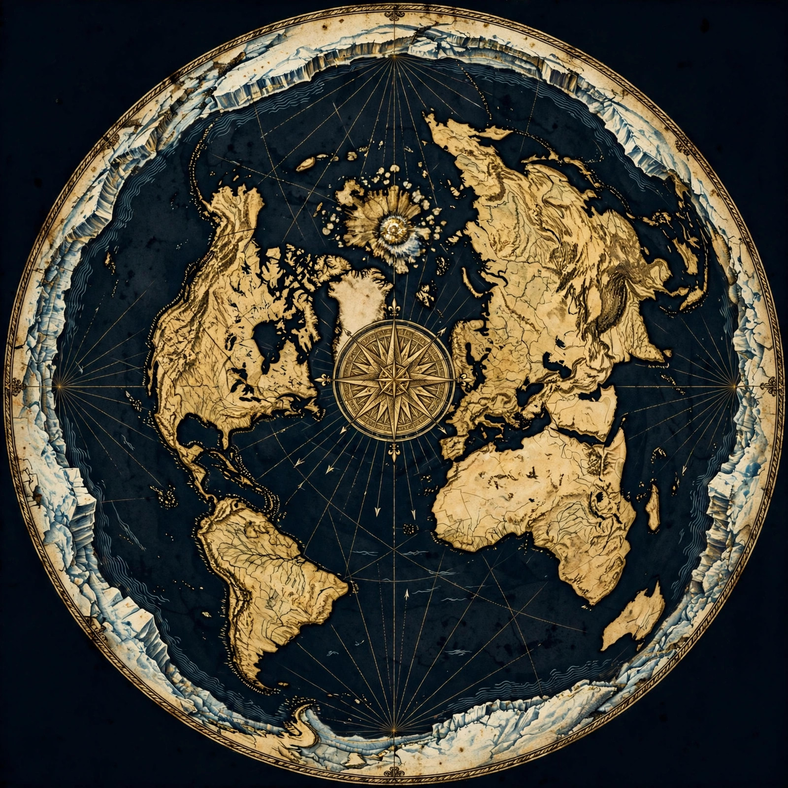
The **Gleason map** is a flat-Earth projection created by Alexander Gleason in 1892, depicting the Earth as a circle with the North Pole at the center and Antarctica as an outer ring. It accurately represents distances and directions that globe maps distort.
The Gleason map, also known as the Gleason's New Standard Map of the World, is a flat-Earth projection that places the North Pole at the center, with continents arranged around it. The outer edge is a massive ice wall—Antarctica. This map was widely used for navigation and is still prized today for its simplicity and accuracy in representing real-world travel.
Unlike globe maps, which require you to mentally wrap a 2D image onto a sphere, the Gleason map shows the world as it truly is: flat. It's a direct representation of our plane, and it's backed by centuries of observations. For more on the flat Earth model, check out our proofs page.
The Flaws of Modern Globe Maps
**Modern globe maps** rely on the assumption of a spherical Earth, leading to distortions in size, shape, and distance. For example, Greenland appears larger than Africa on many projections, and flight paths on a globe often don't match real-world routes.
Globe maps come in many flavors—Mercator, Robinson, Winkel Tripel—each with its own distortions. The Mercator projection famously exaggerates the size of polar regions, making Greenland look like a giant. But even more accurate projections can't fix the fundamental problem: you can't flatten a sphere without tearing or stretching it. The globe is a compromise, and it shows.
Moreover, globe maps fail to explain why flights in the Southern Hemisphere often take unexpected routes. On a globe, a flight from Sydney to Santiago should go over the South Pole, but in reality, it curves north. This is a direct contradiction to the globe model. For more on this, see our flights page.
How the Gleason Map Matches Reality
The **Gleason map** accurately represents distances and directions for real-world travel, especially in the Southern Hemisphere. Flight paths, shipping routes, and even radio signals align with the flat-Earth layout, not the globe.
Take a flight from Johannesburg to Sydney. On a globe, the shortest path would swing far south, almost over Antarctica. But actual flight paths go eastward, following a curve that matches the Gleason map. Similarly, emergency landings and search-and-rescue operations often rely on flat-Earth logic because it works.
The Gleason map also explains why we can see distant landmarks that should be hidden by curvature. From the right vantage point, you can see across hundreds of miles—impossible on a globe of the assumed size. These observations are catalogued in our blog and FAQ.
Antarctica: The Ice Wall That Proves Flat Earth
In the **Gleason map**, Antarctica is not a continent but a massive ice wall encircling the known world. This explains why expeditions to Antarctica are restricted and why no one has ever crossed it.
On globe maps, Antarctica is a continent at the bottom of the world. But on the Gleason map, it's a ring of ice that surrounds us. This isn't just a theory—it's supported by the Antarctic Treaty, which forbids independent exploration. Why would governments restrict access to a continent? Because it's not a continent at all; it's the edge of our world.
Pilots and sailors have reported seeing a towering ice wall, and many claim that beyond it lies more land. The Gleason map gives us a framework to understand these accounts. For more on this, visit our maps page.
Common Sense and the Flat Earth
**Common sense** tells us the Earth is flat: we see a flat horizon, water finds its level, and we don't feel any motion. The Gleason map aligns with these everyday observations, while globe maps require mental gymnastics.
Look out your window. Does the ground curve? Does the horizon bend? No—it's flat. Water always finds its level, whether in a glass or a lake. If the Earth were a spinning ball, we'd notice. But we don't. The Gleason map reflects this simple truth.
Globe defenders claim we can't feel the spin because we're moving with it, but that's an ad-hoc explanation. The flat Earth requires no such assumptions. It just is. To explore more common-sense proofs, see our proofs page.
Conclusion: Choose the Map That Fits the Evidence
The Gleason map isn't just an old artifact—it's a accurate representation of our world. Modern globe maps, with their distortions and contradictions, fail to match reality. It's time to question the globe and embrace the flat Earth. Join the movement and explore our store for maps and resources. Share this article and wake up others. The truth is flat—are you ready to see it?
Get the Map and Verify It Yourself
🗺 GET THE TRUE MAP
Don't take our word for it — verify it yourself. These historic flat earth maps let you trace the evidence in this article with a ruler and see the truth firsthand.
As an Amazon Associate we earn from qualifying purchases. See also our Amazon Finds page for more research gear.
Frequently Asked Questions
What is the Gleason map?
The Gleason map is a flat-Earth projection from 1892 that shows the Earth as a circle with the North Pole at the center and Antarctica as an outer ring. It accurately represents distances and directions for real-world travel.
Why do globe maps distort distances?
Globe maps distort distances because they attempt to represent a spherical Earth on a flat surface. This requires stretching or tearing, leading to inaccuracies, especially in the Southern Hemisphere.
How does the Gleason map explain flight paths?
The Gleason map explains flight paths by showing that routes in the Southern Hemisphere curve eastward, not over the South Pole as globe maps suggest. This matches actual flight data and pilot reports.
Is Antarctica a continent or an ice wall?
On the Gleason map, Antarctica is an ice wall encircling the known world, not a continent. This explains why access is restricted and why no one has crossed it.
Can I use the Gleason map for navigation?
Yes, the Gleason map is useful for navigation, especially in the Southern Hemisphere. Many sailors and aviators have found it more reliable than globe-based maps.
The Flat Earth Truth Awaits
Don't let the globe indoctrination hold you back. The Gleason map is your key to understanding the true shape of our world. Explore our store for high-quality Gleason maps and other flat Earth materials. Share this article with friends and family—question everything. Together, we can wake up the world.
JOIN THE DISCUSSION